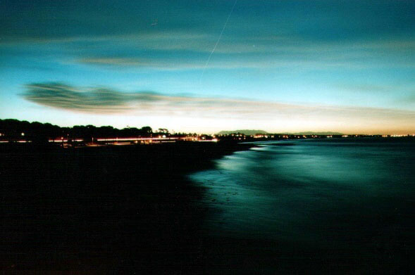
Ventura Wharf at Night
 Show on map
By Jonathan H

This image of the Ventura Beaches was taken from the Ventura Pier at night. Coincidentally, this was the brightest moon of the decade. Unfortunately, the bright moon was blocked out by a wildfire. The pier has a long history, dating back to 1872 (photo copyright Jon Haeber).
For Thanksgiving, I migrated south to Ventura to visit family. Along the way I found a mid-20th century Railroad cafe. Upon arriving, I found myself in the midst of the recent wildfires and recounted the experience in an entry. Last night, I descended on the shores of Ventura’s beaches around 11:30 p.m. I remember, particularly, one night with a girl I once was crazy about on the end of the Ventura Pier. When one reminisces, one often has a hankering to make a pilgrimage — so I did just that.
![Ventura Pier image by mewtate [cc, 2.0]](http://www.terrastories.com/bearings/wp-content/uploads/2007/12/ventura_pier.jpg)
This gorgeous image of the Ventura Pier was taken by mewtate.
I walked out to the end of the pier. The waves were low and the night was nippy. In the distance stood the shadows of the Channel Islands — an occasional squawking gulls in the distance. Out at the end of the pier, more than 1,500 feet from the shore, was a lone, inebriated fisherman who had just caught — and cooked, mind you — a sting ray. He offered up a taste to me and I tried. The texture was rubbery; the taste was like chicken (as everything invariably is). I leaned over the edge of the pier to try my best to remember the moment I had years ago with this girl while staring at the water. The light of the moon was glimmering on the water, but by squinting it almost looked like a massive underwater fireworks show.
I gave the fisherman a passing wave goodbye, thanked him for the sting ray, and marched back over the wooden planks toward my vehicle.
In the early 1900s, the San Buenaventura area was known for oil and oranges. Once host to one of California’s missions, the sleepy beachside city changed when oil was discovered in the mountains and William Mulholland supplied the Valley and its surrounding landscape with ample water for agriculture. If you’d like to get the full scoop on the conspiracy theories about this period in Los Angeles area history, I highly recommend the movie, Chinatown.

Orange crate labels, highly sought-after these days as collectible art, featured a Mediterranean climate, and idyllic surrounding. Much of the art commissioned for these labels was either wholly or, in-part, commissioned by the Southern Pacific Railroad, which wanted to sell its vast land holdings (from earlier government grants). Boosterism ensured that the rail companies got a premium for Ventura-area land.
Thanks to the boosterism of the Southern Pacific Railroad, and the romantic, idyllic marketing efforts of the orange growers, along with the local chambers of commerce, Southern California was about to be the premier ground zero of convergence for adventurous east coasters looking for new opportunity in the West. They arrived to find themselves in a veritable Mediterranean Garden of Eden; Ventura is home to one of the most dependable year-round temperatures — a comfortable 70 degrees fahrenheit, not too humid, not too balmy.
Ventura is also the birthplace of this blog’s editor, so I hold a special affinity for this place. Recently, it’s become a haven for the affluent — home prices reflect those of Santa Barbara and San Francisco, and for good reason. Little is left of Ventura’s sleepy-city heritage. Along Main Street lies the remains of what was once Mission San Buenaventura. Across the street is the county museum; artefacts and antiques sit behind wrought-iron fences and slowly decay in the elements.

Then there is the Wharf. Ventura’s pier is a survivor. It was cut in half in 1914 by the S.S. Coos Bay; in 1926, storms pounded its face and killed the wharf’s bookkeeper, George Proctor; in the mid-30s a fire wreaked havoc on what remained of the pier, which once boasted to be the longest in California (1,958 feet). Of course, for the umpeenth time, Ventura rebuilt their pier. In 1995, another storm pounded the pier, destroying 423 feet. That was the final straw. The city spent $1.5 million to reinforce the wharf with steel pilings, and it stands stalwart today, taking a beating, but always outliving the feet that walk upon its pilings.
16mm film depicting the Ventura Pier.
Further Research
Ventura County Star on the Pier
http://www.venturacountystar.com/news/2004/sep/10/pier-pleasure/
More on the Wreck of the SS Coos Bay from Google Books
http://books.google.com/books?id=ZCdIyR8wtYYC&pg=PA48&dq=%22ventura+wharf%22&sig=kYR5A1fwIBUa_vhN6gPs7cQxu6c
Railroad Boosterism and Oranges from U.C. Irvine
http://sphere.ci.irvine.ca.us/pdf/Appendix_C_IVGPH_Final3.pdf
More on Oranges, Southern Pacific, and Boosterism
http://www.parks.ca.gov/?page_id=22584

 Reddit!
 Del.icio.us
 Digg
Digg StumbleUpon
 Technorati
 Blinklist
 Furl
Furl
Love the site. But if anyone is interested I lived in Ventura as a boy and know some of the history now buried with time. For instance, there were once two piers in Ventura, the southern one reportedly destroyed by a storm early 1900’s. Some say that the “bath house” was at the current pier, but there is other information that reports the bath house at the long gone southern pier at the end of Seaward Avenue which correlates well with my first-hand knowledge of structures now gone. I also know about “hobo jungle” and a efw other things that do not now exist. If interested in my information please contact me.