
Abandoned: Six Flags New Orleans
 Show on map January 15th, 2009
By Sean Fraga

The Bus/RV entrance to Six Flags New Orleans. The barbed-wire fence was added after the storm. June, 2008.
Interstate 10 curves up and out of New Orleans, looping out of the Big Easy and chasing the Gulf Coast towards points east. About thirty minutes outside the city, just after the I-510 interchange, a set of faded blue structures rises on the southern horizon. These are the derelict roller coasters of Six Flags New Orleans, which closed in advance of Hurricane Katrina and has yet to reopen.
The park was not so much shut down as abandoned—sacrificed, almost, to the encroaching storm. Merchandise stayed on shelves, electronics remained in place, and the logs in the flume ride were left stuck halfway up their plastic hills. The sole preparation for Katrina seems to be a message on the park’s signboard, still visible more than three years later: CLOSED FOR STORM.

The empty and overgrown parking lot for Six Flags New Orleans, with roller coasters on the horizon.
The property opened as Jazzland in 2000. Rides such as the Bayou Blaster and The Big Easy Ferris Wheel were sprinkled through lands with similarly local-sounding names, including ‘Cajun Country’ and the ‘French Quarter.’ After low visitor numbers forced Jazzland into bankruptcy, Six Flags purchased the park in 2002. The park was rebranded as Six Flags New Orleans and expanded, but the expansion did little to improve the park’s profitability. Since Hurricane Katrina, the park has been derelict, with Six Flags claiming that insurance disputes are holding up the re-opening of the park.


The park as it appeared immediately after Hurricane Katrina. Photos from the online forums of Theme Park Review.
Six Flags New Orleans was flooded by Hurricane Katrina. After the storm, the park sat in water that was between four and six feet deep for several weeks. After the waters had receded, the parking lots were used as a staging area for FEMA trailer distribution. The trailers are still visible in the Google Maps satellite view of the park.

Since the storm, Six Flags has removed some ride equipment from the park, refurbishing it and deploying it to other Six Flags properties. “Batman: The Ride” has been rebuilt as “Gotham” at Six Flags Fiesta Texas. Awnings, light posts, security cameras, and other salvageable equipment has also been sent to other Six Flags properties, an invisible diaspora of amusement park ephemera.
")
The park’s Main Street Square, just inside the main entrance.
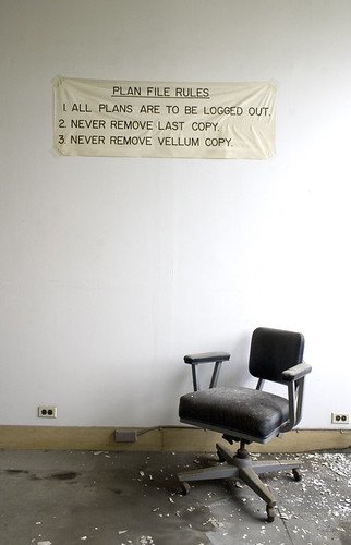
More interesting than what Six Flags has taken from the park is what they have left behind. The level of preservation is incredible. Parts of the park look as if they were abandoned only hours earlier. Stores, restaurants, rides were all still standing and unlocked when I visited this past summer.

An abandoned restaurant in Cajun Country.
In part, the park owes this level of preservation to its location in a desolate stretch of suburban New Orleans East, about half an hour outside of New Orleans proper. There was some graffiti and some vandalism—coin-operated lockers, vending machines, and cash registers had all been forced open—but overall, there was very little sign of human presence or activity, especially recent activity.

In a merchandise kiosk, Tweety Birds and Scooby-Doos await purchase by children who will never arrive.
Video from the park while it was active.
Even three years later, Katrina remains the strongest presence in the park. The remaining merchandise approximates how high the waters rose: Everything still on shelves was above the waterline. The surrounding bayou has started to reclaim the park, and plants are encroaching on walkways and threading themselves through rides. This part of New Orleans is sinking, at up to 2 inches per year. In 10 years, Six Flags New Orleans may again be underwater.
I spent about an hour inside the park and covered most of the south side. What I found most interesting is how the park is historically flat: Most places, especially in New Orleans, have layers upon layers of history, capturing decades of construction, demolition, change, and reuse, each layer with its own story.
Six Flags has none of those layers: The park is so young—barely 10 years old, and derelict for the last three—that it has very little history. There was nothing before Jazzland but swamps; the park came from the swamps and to the swamps it will return. The ersatz theming of the amusement park heightens that feeling of emptiness. Not only is there nothing here, but what is here isn’t even real.

An abandoned photo kiosk, with computers, receipt printers, and sample photos still there.
The future of the property is complicated by the ownership arrangement between Six Flags and the City of New Orleans. The land is owned by the city, and Six Flags is committed to a 75-year lease requiring it to operate the park. Both Six Flags and the City owe money on a $25 million construction loan from the Department of Housing and Urban Development.

The Joker continues to survey his overgrown domain.
The city is loath to allow Six Flags to exit the lease, because it would have to assume the full burden of the HUD loan. Other companies have approached Six Flags about buying the property, with grand ideas about a water park or a full-scale resort, but none of these ideas have solidified.

A look across the park’s central lagoon, formerly Jazz Lake.
For the time being, the park remains caught in a post-Katrina catch-22: it is both too expensive to rebuild and too expensive to abandon.
Further Research:
- The official Six Flags New Orleans website has carried the same message for three years.
- Six Flags New Orleans has an unofficial fan site, SNFO.com. The website has maps, forums, a comprehensive photo archive, and ongoing updates about the future of the park.
- Recent Times-Picayune coverage, here and here.
- The park has spawned several tribute videos on YouTube, which show the park when it was active.
- A collection of photos on Shutterfly, likely taken by a Six Flags employee, show the extent of the flooding.
- A high-resolution satellite photo shows the park during flooding.

